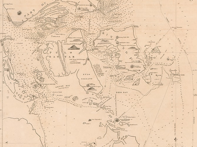
Horsburgh’s Chart of the Islands and Channels At the Southwest Extremity of the China Sea
Captain James Horsburgh cuts off Singapore’s western end and depicts it as two islands. He did correctly identify the location of ‘red cliffs’ where Tanah Merah is today.
1824
Other Maps


Be sure to reserve your tickets early for this immersive experience that showcases key moments in Singapore's 700-year history.
Be sure to reserve your tickets early for this immersive experience that showcases key moments in Singapore's 700-year history.