Throughout the 19th century, the area now known as Ang Mo Kio was largely uninhabited. Old maps labelled it the Ang Mo Kio Forest Reserve, for it was mostly forest and plantation estates. A report back in 1849 attributed to one J.T. Thomson, a government surveyor, actually mentioned ‘Amokiah’, noting that the land contained sandstone. This could explain how Ang Mo Kio got its name.
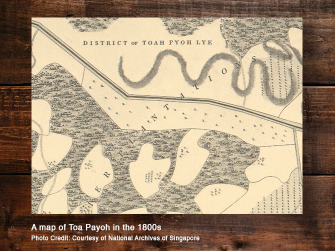
In a map dating back to 1842, Toa Payoh, spelt ‘Toah Pyoh’, was mostly swamp and forest. However, in the 19th century, land was acquired and cleared for the setting up of pepper and gambier plantations. A report conducted by the Municipal Committee counted 355,000 gambier trees, 38,800 pepper vines and 2,190 nutmeg trees across the area.

The colourful enclaves of Kreta Ayer and Kampong Glam

In the early 1800s, water-carrying bullock and ox carts plied the road of Kreta Ayer, which translates to ‘water cart’ in Malay. In 1922, it was officially named Kreta Ayer Road. From 1826, the Kreta Ayer district of Chinatown developed at a faster rate with many surrounding streets being developed. As a result, the Chinese divided the area into two sections: tua poh (greater town) and sio poh (smaller town). Restaurants, brothels and theatres helped to shape the more prosperous tua poh. From the colonial period up till mid-1900s, a popular source of public entertainment in the area was Wayang, performed on makeshift stages. The need for a permanent stage so that artists can perform led to the Kreta Ayer People’s Theatre being built in 1969.
Farther afield, Kampong Glam, previously known as Seduyong, was where the Orang Laut from the Glam tribe lived. In 1824, the area was set aside for Sultan Hussein and his 600 family members where he had a large attap-roof palace built. The area also housed the Bugis, Javanese as well as other Malay traders from Palembang, Riau and the Peninsular. Subsequently, the bustling trade of the area attracted Indian and Chinese merchants too.


A modern neighbourhood in Kallang today, Kolam Ayer was mostly a swampland in early 1800s. The area was inhabited by Orang Kallang, boat dwellers who lived at the mouth of Kallang River. As a source of income, they would collect and process Nipah leaves to make Malay-style palm-leaf cigarette wrappers. They also provided water transportation and ferry services, as well as gathered mangrove wood to be sold as fuel.
The area of Whampoa is named after Hoo Ah Kay, a notable Chinese businessman born in Whampoa, China. Arriving in Singapore at the age of 15 in 1830, Hoo worked at his father’s provision shop supplying beef, bread and vegetables. After his father’s death, he expanded the business to set up a company called Whampoa & Co. His surprising mastery over English gave him an edge in business and social interactions with the British, making him an important bridge between the Chinese and the colonial government. Hoo was also the first and only Chinese to be an extraordinary member in the Executive Legislative Council.
It is said that Tanjong Pagar means ‘cape of stakes’, and its name was inspired by a kelong that stretched from Tanjong Malang to present-day Tanjong Pagar. Another historical account attributes the name to being derived by a barricade of banana stems built to prevent villages along the coast from falling prey to sword fish attacks.
----
